
File:LocationSouthAfrica.png
ཧུམ་ཆ་ལེགས་ཤོམ་མིན་འདུག།
LocationSouthAfrica.png (༢༥༠ × ༡༡༥ པིག་སེལ་ ཡིག་སྣོད་ཀྱི་ཚད་: ༥ KB མའིམ་དབྱེ་བ་: image/png)
Afrikaans: 'n Geografiese kaart om die posisie van Suid-Afrika aan te dui.
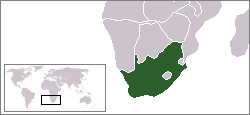
English: Location map for South Africa.
Čeština: Poloha Jihoafrické republiky.
Originally created for English Wikipedia by Vardion.
| |
This work has been released into the public domain by its author, Vardion, at the [[::|ཨིང་ལིཤ་ཁ Wikipedia]] project. This applies worldwide. In case this is not legally possible: |

|
File:LocationSouthAfrica.svg is a vector version of this file. It should be used in place of this PNG file when not inferior.
File:LocationSouthAfrica.png → File:LocationSouthAfrica.svg
For more information, see Help:SVG. |
 |
ཡིག་སྣོད་སྤྱོད་ཤུལ།
ཡིག་སྣོད་འདི་ དེ་བསྒང་སྟོན་དོ་བཟུམ་སྦེ་ བལྟ་ནི་གི་དོན་ལུ་ ཚེས་གྲངས་/ཆུ་ཚོད་གུ་ ཨེབ་གཏང་འབད།
| ཚེས་གྲངས་/ཆུ་ཚོད། | Thumbnail | རྒྱ་ཚད་ | ལག་ལེན་པ། | བསམ་བཀོད། | |
|---|---|---|---|---|---|
| ད་ལྟོ། | ༠༣:༢༣, ༡༣ སྤྱི་ཟླ་བཅུ་གཉིས་པ། ༢༠༠༤ | | ༢༥༠ × ༡༡༥ (༥ KB) | EugeneZelenko | Location map for the South Africa.<br/>Originally created for English Wikipedia by Vardion.<br/>{{PD}}<br/>Category:Country locator maps |
འབྲེལ་ལམ།
འོག་གི་ཤོག་ལེབ་ཚུ་ ཡིག་སྣོད་འདི་དང་འབྲེལ་བ་འདུག:
Global file usage
The following other wikis use this file:
- Usage on ar.wikinews.org
- قالب:جنوب أفريقيا
- جنوب أفريقيا تفرض ملصقات لتمييز بضائع الأراضي المحتلة عن المصنوعة في إسرائيل
- قيادة الشرطة في بيترماريتزبرغ توقف اختبارات القبول بعد وفاة سبعة مرشحين
- رئيس جنوب إفريقيا يدعو مواطنيه للامتناع عن زيارة "إسرائيل"
- حماس تشيد بدعوة رئيس جنوب إفريقيا عدم زيارة "إسرائيل"
- اعتماد المجلس الوطني الفلسطيني عضواً مراقباً في البرلمان الإفريقي
- جنوب إفريقيا تعلن مقاطعتها القمة الإفريقية-"الإسرائيلية"
- حفيد مانديلا: فلسطين تعاني من أسوأ أنواع الأبارتهايد
- أغنية كأس أمم أفريقيا تحتفي بالسلام
- Usage on bpy.wikipedia.org
- Usage on br.wikipedia.org
- Usage on br.wiktionary.org
- Usage on ca.wikipedia.org
- Usage on ceb.wikipedia.org
- Usage on de.wikipedia.org
- Bontebok-Nationalpark
- Addo-Elefanten-Nationalpark
- Mountain-Zebra-Nationalpark
- West-Coast-Nationalpark
- ISimangaliso-Wetland-Park
- Augrabiesfälle
- Tsitsikamma-Nationalpark
- Goegap Nature Reserve
- Namaqua-Nationalpark
- Anysberg Nature Reserve
- Tankwa-Karoo-Nationalpark
- De Mond Nature Reserve
- Oorlogskloof Nature Reserve
- Grootvadersbosch Nature Reserve
- Rocherpan Nature Reserve
- Golden-Gate-Highlands-Nationalpark
- Akkerendam Nature Reserve
- Marloth Nature Reserve
- De Hoop Nature Reserve
- Gamkaberg Nature Reserve
- Bird Island Nature Reserve
- Midmar Nature Reserve
- Hluhluwe-iMfolozi-Park
- Karoo-Nationalpark
- Knysna National Lake Area
- Mapungubwe-Nationalpark
- Marakele-Nationalpark
- Tafelberg-Nationalpark
- Wilderness-Nationalpark
- Agulhas-Nationalpark
- Caledon Nature Reserve (Freistaat)
- Mokala-Nationalpark
- Camdeboo-Nationalpark
- Garden-Route-Nationalpark
- Tembe Elephant Park
View more global usage of this file.