
File:Location UK EU Europe.png
Size of this preview: ༧༡༤ × ༦༠༠ pixels. Other resolutions: ༢༨༦ × ༢༤༠ pixels | ༥༧༢ × ༤༨༠ pixels | ༩༡༥ × ༧༦༨ pixels | ༡,༢༡༩ × ༡,༠༢༤ pixels | ༢,༠༤༨ × ༡,༧༢༠ pixels.
ཧུམ་ཆ་གང་། (༢,༠༤༨ × ༡,༧༢༠ པིག་སེལ་ ཡིག་སྣོད་ཀྱི་ཚད་: ༥༩༧ KB མའིམ་དབྱེ་བ་: image/png)
Summary
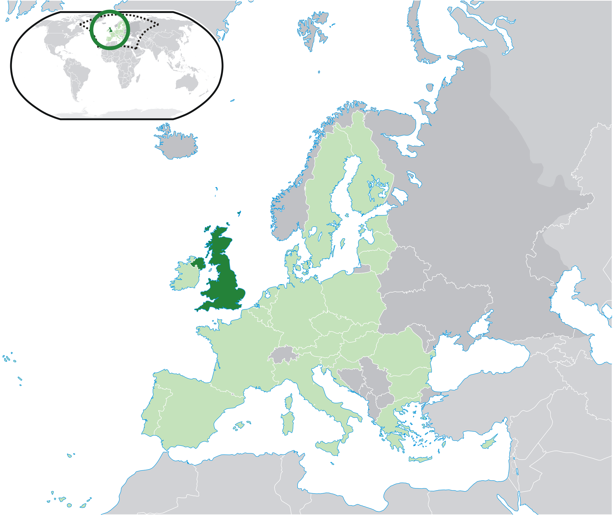
| Description | Location map: United Kingdom (dark green) / European Union (light green) / Europe (dark grey); inspired by and consistent with general country locator maps by User:Vardion, et al. | |||
| Date | ||||
| Source | Own work | |||
| Author | Quizimodo | |||
| Other versions |
Derivative works of this file: Location UK EU Europe 001.svg |


Licensing
| This work has been released into the public domain by its author, I, Quizimodo. This applies worldwide. In some countries this may not be legally possible; if so: I, Quizimodo grants anyone the right to use this work for any purpose, without any conditions, unless such conditions are required by law. |
ཡིག་སྣོད་སྤྱོད་ཤུལ།
ཡིག་སྣོད་འདི་ དེ་བསྒང་སྟོན་དོ་བཟུམ་སྦེ་ བལྟ་ནི་གི་དོན་ལུ་ ཚེས་གྲངས་/ཆུ་ཚོད་གུ་ ཨེབ་གཏང་འབད།
| ཚེས་གྲངས་/ཆུ་ཚོད། | Thumbnail | རྒྱ་ཚད་ | ལག་ལེན་པ། | བསམ་བཀོད། | |
|---|---|---|---|---|---|
| ད་ལྟོ། | ༡༨:༣༠, ༢༨ སྤྱི་ཟླ་བདུན་པ། ༢༠༢༠ | | ༢,༠༤༨ × ༡,༧༢༠ (༥༩༧ KB) | Maphobbyist | Update: South Audan border |
| ༡༥:༠༠, ༡ སྤྱི་ཟླ་བཅུ་པ། ༢༠༡༤ |  | ༢,༠༤༨ × ༡,༧༢༠ (༤༡༣ KB) | Maphobbyist | Update: Croatia | |
| ༠༣:༤༧, ༡༠ སྤྱི་ཟླ་བདུན་པ། ༢༠༠༨ |  | ༢,༠༤༨ × ༡,༧༢༠ (༢༦༡ KB) | Pureditor | Reverted to version as of 13:11, 4 July 2007 | |
| ༡༨:༠༤, ༢༣ སྤྱི་ཟླ་དྲུག་པ། ༢༠༠༨ |  | ༢,༠༤༨ × ༡,༧༢༠ (༤༡༣ KB) | IJA | minor | |
| ༡༣:༡༡, ༤ སྤྱི་ཟླ་བདུན་པ། ༢༠༠༧ |  | ༢,༠༤༨ × ༡,༧༢༠ (༢༦༡ KB) | Quizimodo~commonswiki | image (updated) | |
| ༡༣:༠༣, ༤ སྤྱི་ཟླ་བདུན་པ། ༢༠༠༧ |  | ༢,༠༤༨ × ༡,༧༢༠ (༢༦༡ KB) | Quizimodo~commonswiki | image (updated) | |
| ༠༤:༡༤, ༣༠ སྤྱི་ཟླ་དྲུག་པ། ༢༠༠༧ |  | ༢,༠༥༦ × ༡,༧༢༧ (༢༣༥ KB) | Quizimodo~commonswiki | updated map w/blue coastlines, Anglesey | |
| ༠༡:༠༡, ༡༨ སྤྱི་ཟླ་དྲུག་པ། ༢༠༠༧ |  | ༢,༠༥༦ × ༡,༧༡༠ (༡༧༦ KB) | Quizimodo~commonswiki | image (updated) | |
| ༡༠:༥༦, ༡༧ སྤྱི་ཟླ་དྲུག་པ། ༢༠༠༧ |  | ༢,༠༥༦ × ༡,༧༡༠ (༢༢༩ KB) | Quizimodo~commonswiki | {{Information |Description=Location map: United Kingdom (dark green) / European Union (light green) / Europe (dark grey); inspired by and consistent with general country locator maps by User:Vardion, et al |Source=self-made |Date=17 June 2007 |Author= [[U |
འབྲེལ་ལམ།
འོག་གི་ཤོག་ལེབ་ཚུ་ ཡིག་སྣོད་འདི་དང་འབྲེལ་བ་འདུག:
Global file usage
The following other wikis use this file:
- Usage on bi.wikipedia.org
- Usage on bn.wikibooks.org
- Usage on bo.wikipedia.org
- Usage on cbk-zam.wikipedia.org
- Usage on en.wikibooks.org
- Usage on en.wikinews.org
- Usage on eu.wiktionary.org
- Usage on fr.wikibooks.org
- Usage on fr.wiktionary.org
- Usage on gu.wikipedia.org
- Usage on id.wikibooks.org
- Usage on krc.wikipedia.org
- Usage on mai.wikipedia.org
- Usage on nl.wikibooks.org
- Usage on pnb.wikipedia.org
- Usage on pt.wikibooks.org
- Usage on ro.wikibooks.org
- Usage on ro.wikinews.org
- Doi morți în exploziile de la Londra
- Papandreou declară că Grecia are nevoie de sprijin, nu de împrumuturi
- Format:Marea Britanie
- Mii de persoane au protestat împotriva arestării lui Ganic
- Marea Britanie îl eliberează pe Ganic pe cauțiune
- O curte din Londra amână audierea în cazul Ganic
- Wikipedia va fi relansată pe 5 aprilie
- Livrări suspendate din cauza unei pisici care a atacat poștașii
- Chelsea FC a câștigat campionatul Angliei
- Albania și Marea Britanie semnează un acord privitor la schimburile de informații
- Huliganii din Anglia s-au potolit - fapte, ipoteze, concluzii
- A început Turneul de Tenis de la Wimbledon. Rezultatele românilor în prima zi
- Simona Halep s-a calificat în turul doi la Wimbledon
- Rezultate Wimbledon: ziua a doua
- Rezultate Wimbledon. Ziua a treia
- Simona Halep a pierdut în turul doi la Wimbledon
- Rezultate Wimbledon 2013: Andy Murray, primul britanic care câștigă titlul la Wimbledon după 77 de ani
- Fiica prințului William și a lui Kate va purta numele Charlotte
- Prim-ministrul Marii Britanii, David Cameron, cere lovituri aeriene britanice contra ISIS în Siria
- Regatul Unit a început loviturile aeriene împotriva ISIS în Siria
- Usage on sah.wikipedia.org
- Usage on shn.wikibooks.org
- Usage on sn.wikipedia.org
- Usage on su.wikipedia.org
- Usage on tpi.wikipedia.org
- Usage on ug.wikipedia.org
- Usage on yo.wikipedia.org