
File:Location Portugal EU Europe.png
Size of this preview: ༧༡༤ × ༦༠༠ pixels. Other resolutions: ༢༨༦ × ༢༤༠ pixels | ༥༧༢ × ༤༨༠ pixels | ༩༡༥ × ༧༦༨ pixels | ༡,༢༡༩ × ༡,༠༢༤ pixels | ༢,༠༤༨ × ༡,༧༢༠ pixels.
ཧུམ་ཆ་གང་། (༢,༠༤༨ × ༡,༧༢༠ པིག་སེལ་ ཡིག་སྣོད་ཀྱི་ཚད་: ༢༣༩ KB མའིམ་དབྱེ་བ་: image/png)

|
File:EU-Portugal with islands circled.svg is a vector version of this file. It should be used in place of this PNG file when not inferior.
File:Location Portugal EU Europe.png → File:EU-Portugal with islands circled.svg
For more information, see Help:SVG. |
 |
Summary
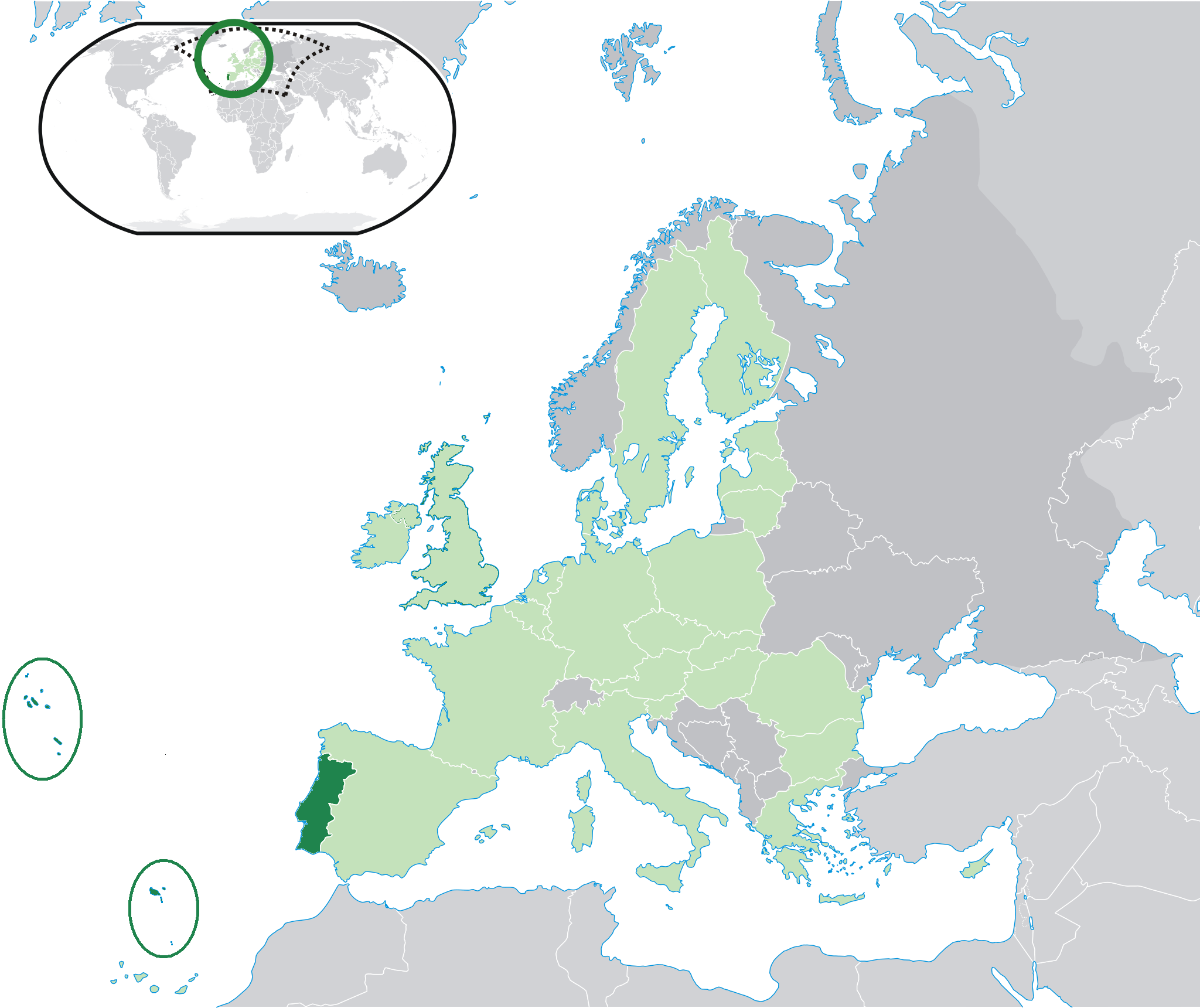
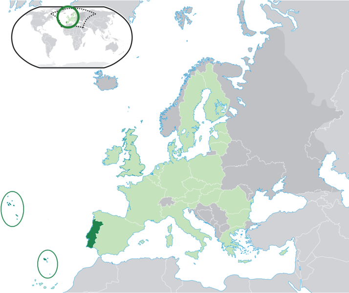
| Description | Location map: Portugal (dark green) / European Union (light green) / Europe (dark grey); inspired by and consistent with general country locator maps by User:Vardion, et al. |
| Date | |
| Source | Own work |
| Author | Quizimodo |
| Other versions |
|


Licensing
| This work has been released into the public domain by its author, I, Quizimodo. This applies worldwide. In some countries this may not be legally possible; if so: I, Quizimodo grants anyone the right to use this work for any purpose, without any conditions, unless such conditions are required by law. |
ཡིག་སྣོད་སྤྱོད་ཤུལ།
ཡིག་སྣོད་འདི་ དེ་བསྒང་སྟོན་དོ་བཟུམ་སྦེ་ བལྟ་ནི་གི་དོན་ལུ་ ཚེས་གྲངས་/ཆུ་ཚོད་གུ་ ཨེབ་གཏང་འབད།
| ཚེས་གྲངས་/ཆུ་ཚོད། | Thumbnail | རྒྱ་ཚད་ | ལག་ལེན་པ། | བསམ་བཀོད། | |
|---|---|---|---|---|---|
| ད་ལྟོ། | ༡༩:༤༧, ༢༦ སྤྱི་ཟླ་བདུན་པ། ༢༠༠༩ | | ༢,༠༤༨ × ༡,༧༢༠ (༢༣༩ KB) | The Ogre | Small correction |
| ༡༤:༣༧, ༢༤ སྤྱི་ཟླ་བདུན་པ། ༢༠༠༩ |  | ༢,༠༤༨ × ༡,༧༢༠ (༢༤༡ KB) | The Ogre | Still better visivility of islans (in agreement with the fact that the Savage islands ar a part of the Madeira archipelago) | |
| ༡༤:༣༠, ༢༤ སྤྱི་ཟླ་བདུན་པ། ༢༠༠༩ |  | ༢,༠༤༨ × ༡,༧༢༠ (༢༤༡ KB) | The Ogre | Better visibility of islands in the Atlantic | |
| ༡༤:༡༣, ༢༤ སྤྱི་ཟླ་བདུན་པ། ༢༠༠༩ |  | ༢,༠༤༨ × ༡,༧༢༠ (༢༤༠ KB) | The Ogre | Small corrections - included the islands of Corvo and Flores in the Azores, and the Desertas and Savage islands in Madeira. | |
| ༠༡:༠༦, ༡༨ སྤྱི་ཟླ་དྲུག་པ། ༢༠༠༧ |  | ༢,༠༥༦ × ༡,༧༡༠ (༡༧༦ KB) | Quizimodo~commonswiki | image (updated) | |
| ༡༠:༡༣, ༡༧ སྤྱི་ཟླ་དྲུག་པ། ༢༠༠༧ |  | ༢,༠༥༦ × ༡,༧༡༠ (༢༢༧ KB) | Quizimodo~commonswiki | image (tweaked) | |
| ༡༠:༠༦, ༡༧ སྤྱི་ཟླ་དྲུག་པ། ༢༠༠༧ |  | ༢,༠༥༦ × ༡,༧༡༠ (༢༢༧ KB) | Quizimodo~commonswiki | image (tweaked) | |
| ༠༧:༥༣, ༡༧ སྤྱི་ཟླ་དྲུག་པ། ༢༠༠༧ |  | ༢,༠༥༦ × ༡,༧༡༠ (༢༢༧ KB) | Quizimodo~commonswiki | image (tweaked) | |
| ༠༧:༡༨, ༡༧ སྤྱི་ཟླ་དྲུག་པ། ༢༠༠༧ |  | ༢,༠༥༦ × ༡,༧༡༠ (༢༢༣ KB) | Quizimodo~commonswiki | image (tweaked) | |
| ༠༦:༤༥, ༡༧ སྤྱི་ཟླ་དྲུག་པ། ༢༠༠༧ |  | ༢,༠༥༦ × ༡,༧༡༠ (༢༢༧ KB) | Quizimodo~commonswiki | {{Information |Description=Location map: Portugal (dark green) / European Union (light green) / Europe (dark grey); inspired by and consistent with general country locator maps by User:Vardion, et al |Source=self-made |Date= |Author= [[User:Quizimodo|Quiz |
འབྲེལ་ལམ།
འོག་གི་ཤོག་ལེབ་ཚུ་ ཡིག་སྣོད་འདི་དང་འབྲེལ་བ་འདུག:
Global file usage
The following other wikis use this file:
- Usage on bcl.wikipedia.org
- Usage on ceb.wikipedia.org
- Usage on de.wikinews.org
- Usage on dv.wikipedia.org
- Usage on es.wikipedia.org
- Usage on es.wikiquote.org
- Usage on eu.wiktionary.org
- Usage on fr.wikipedia.org
- Usage on gag.wikipedia.org
- Usage on got.wikipedia.org
- Usage on gu.wikipedia.org
- Usage on ka.wikipedia.org
- Usage on kn.wikipedia.org
- Usage on ku.wiktionary.org
- Usage on no.wikipedia.org
- Usage on pl.wiktionary.org
- Usage on pt.wikinews.org
- Usage on ro.wikipedia.org
- Usage on ro.wikibooks.org
- Usage on te.wikipedia.org
- Usage on ug.wikipedia.org
- Usage on zh-classical.wikipedia.org